 The weeds and snow added to the loneliness of this old car.
Posts Tagged: Snow
19
Jun 17
A Look Back—Bodie Abandoned Houses
 Many of the houses in Bodie still have plates on the kitchen tables. It seems as though everyone left at once, though I’m sure that wasn’t the case.
12
Jun 17
A Look Back—Bodie Methodist Church
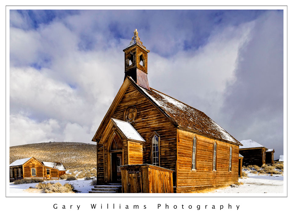 This is one of two churches in Bodie, the abandoned mining town. It was built in 1882 and the last services were held in 1932. There were two churches and sixty-five saloons in town.
24
Apr 17
A Look Back—Snow Covered Peak
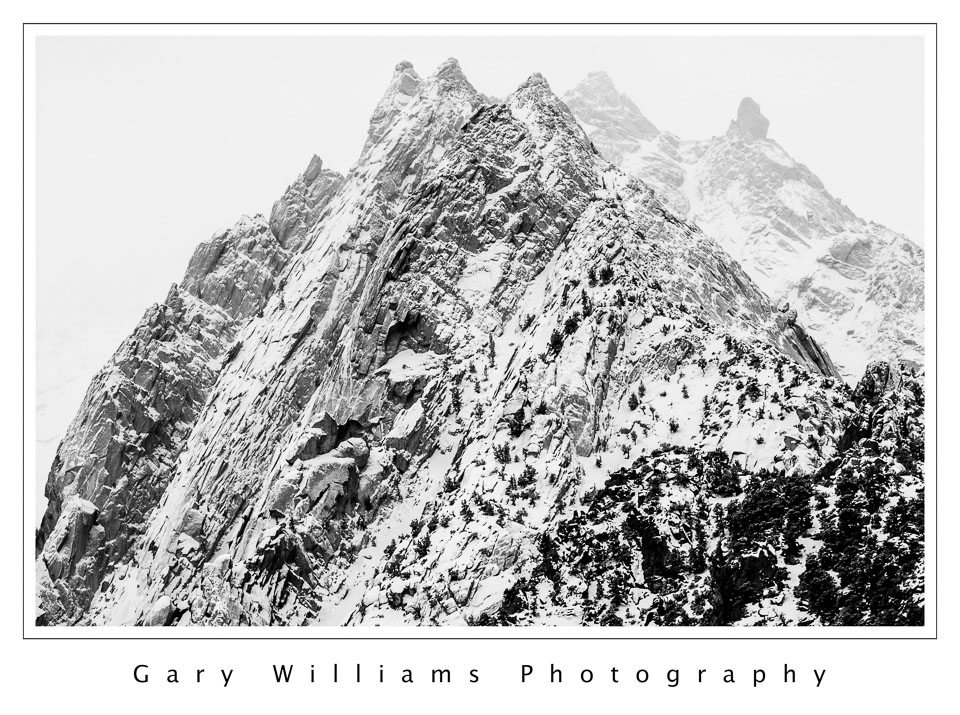 An overlooked shot from a trip to the eastern Sierra Nevada in March of 2006. Snow prevented me from going higher in elevation, but a telephoto zoom brought this peak in close. There was so little color in the scene that I thought it looked better in black and white.
1
Aug 16
New Mexico—Descending From Los Alamos
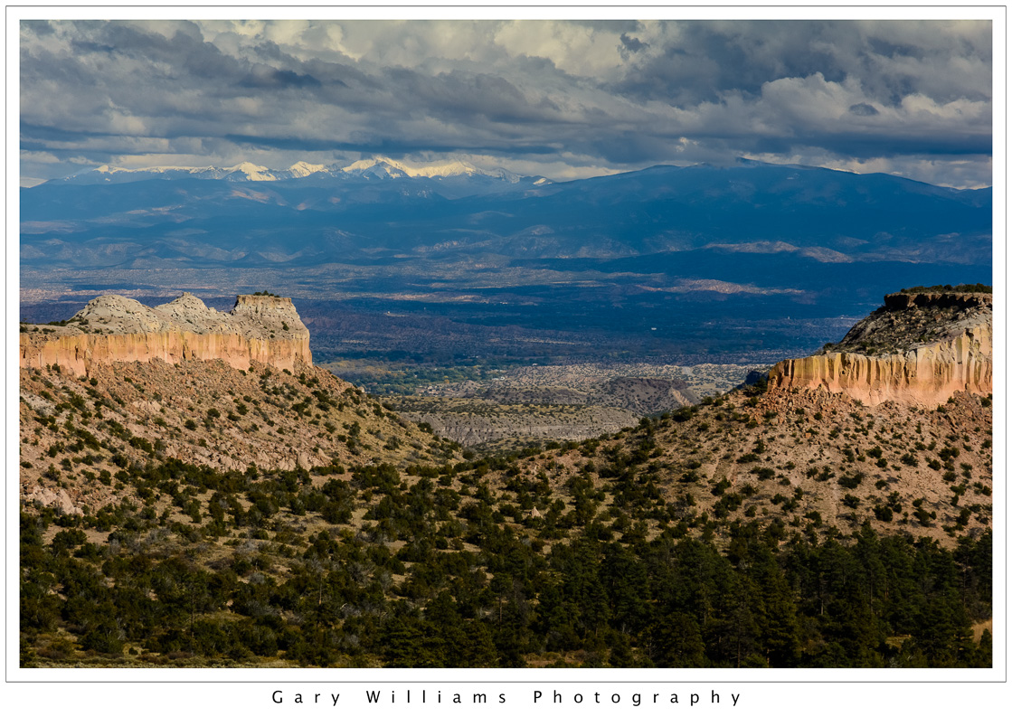 Descending in elevation from Los Alamos, New Mexico, we stopped at this pullout on the highway. Another day of light and shadow, clouds and sweeping vistas. New Mexico, indeed, is the “Land of Enchantment.”
23
May 16
New Mexico—Carson Forest Snowstorm
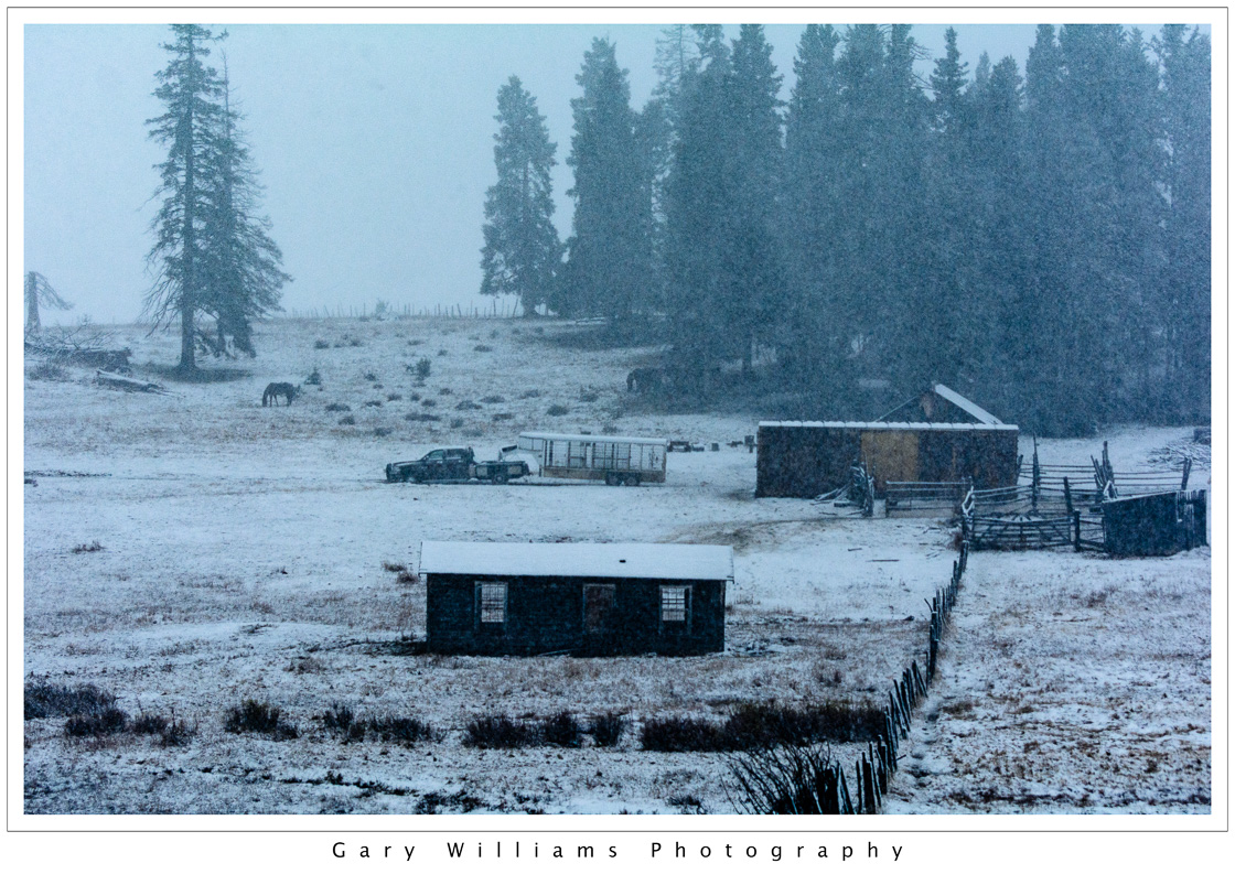 We planned a trip to Chama, New Mexico, along highway 64. Rain, however, quickly turned into snow, and, soon, the road disappeared completely. We turned back shortly after we passed this isolated ranch.
30
Mar 15
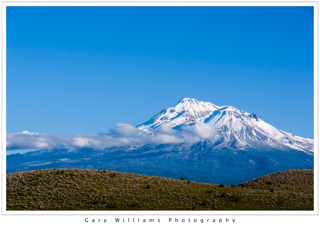
Road Trip–Mount Shasta From The West
 Leaving California two weeks before, I had seen Mount Shasta from Highway 97. The sun was just rising then. Here, a different angle, from Interstate 5, in mid-morning light.
22
Dec 14
Road Trip–Mount Shasta 2
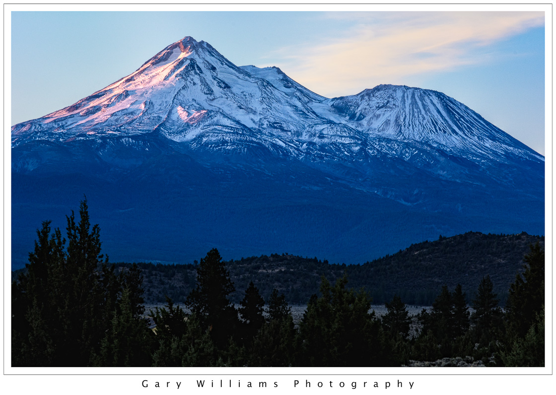 Mount Shasta rises nearly 10,000 feet above the surrounding terrain and is not connected to any other mountains nearby. It is visible for over one hundred miles. It is a volcano and has erupted on an average of every 600 to 800 years over the last 10,000 years. The last major eruption may have happened about 200 years ago.
15
Dec 14
Road Trip–Mount Shasta
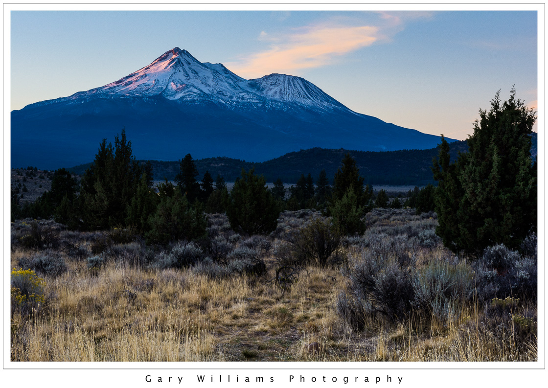 Two weeks in October of 2014 was the chance for a road trip to Oregon and Washington states, a welcome opportunity to camp and photograph beautiful country. The second morning I left my campsite before dawn and was driving north to Oregon when I looked in the rear view mirror and saw Mount Shasta in the early morning light. It is hard to forget the fifth highest mountain in California, but I was so focused on Oregon that I had completely forgotten I would be driving by it. I’m glad I looked back.